The Alpine Tunnel Trip – An Adventure on a Gryffin 250
October 26, 2022
Share this post
The Alpine Tunnel Trip- Adventure on a Gryffin 250
By James Pekarek
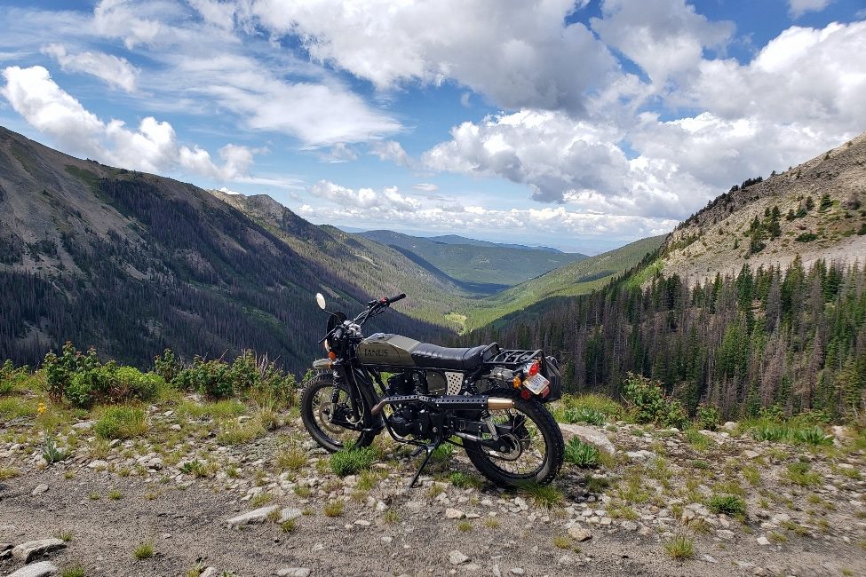
August 2nd, 2022: It’s sunny and cool as I walk out of the hotel in Gunnison, Colorado and begin the process of unloading Gryffin #109 (aka ‘Sherman’) from the trailer. With the bike unloaded, I make a few final checks before starting my trek into the mountains to see the famous Alpine Railroad Tunnel. As a lifelong fan of railroads and their associated history, I’ve always had a soft spot for the narrow gauge railroads in Colorado. The somewhat obscure Denver, South Park and Pacific Railroad is perhaps the premier example of three foot gauge mountain railroading. The little company built the highest railroad tunnel in the United States in 1880-82, the first tunnel to cross the Continental Divide. The line from Alpine Tunnel down to Pitkin is regarded as some of the most spectacular railroad scenery in America. It was something that I felt needed to be seen in person.
In 2013, my wife and I made a feeble attempt at going up the mountain, but quickly discovered our little car was no match for the rough, abandoned grade. We both agreed that it would be best to try again sometime in the future with different vehicle, something that was more capable off-road.
Fast forward to December, 2021. I had been stalking the Gryffin on the Janus website for quite some time. There were a lot of reasons why I wanted the little scrambler, but the possibility of a trip up to Alpine Tunnel was at the top of the list. My patient wife had one request – it had to be O.D. Green. As if the good folks at Janus were reading my mind, my email lit up with an end-of-year special on all 250’s, and I plunked down a deposit on Gryffin #109.
The bike was in my shop by the end of January. It was time to start planning the pilgrimage.
Given the location of the line, a summertime visit is a must. My wife agreed to an August vacation, and I reserved an enclosed cargo trailer from everyone’s favorite rental company to transport #109 and our luggage. The route from the hotel to the Alpine Tunnel Historic Site isn’t especially complex, but given the remote location, I made sure to carefully plan and review the directions. I would ride up to the tunnel, my wife would stay at the hotel and watch movies, and we would enjoy a nice supper together later that day.
Finally, the time arrived to pick up the trailer, load the bike & luggage, and head west.
And now, I’m finally in Gunnison unloading the bike, checking it over, and making sure I have everything I think I might need for the ride. Yes, it should be less than 80 miles, but the terrain is unforgiving and remote – better safe than sorry. With the bike ready, I suit up and start the engine. And yet, one question was in the back of my mind: Would the experience live up the anticipation?
We have all had those experiences – the ones where we look forward to something, and then when the time arrives, we are disappointed with actual proceedings. We find out that the anticipation was somehow more exciting that the event itself. At times, it may seem that the longer the wait, the greater the disappointment. Would this adventure live up to my expectations? It was time to find out.
Leaving the hotel, I have about a ten mile ride down Highway 50, a two-lane road with a 65 mph speed limit. Of course, little #109 isn’t going to run 65 mph – Gunnison’s elevation is around 7700’ and the bike is feeling the effects of the thin air, running a bit rich and making a little less power. The jetting is spot-on at home, so I had decided against trying to re-jet it for a one-day ride at high altitudes… I know it won’t run perfect at these elevations, but it will be good enough. It feels like 45-50 mph is the sweet spot, with minimal blubbering from the carbureted engine. At least Highway 50 has nice, wide shoulders, so I’m able to pull to the side and let other traffic pass as needed.
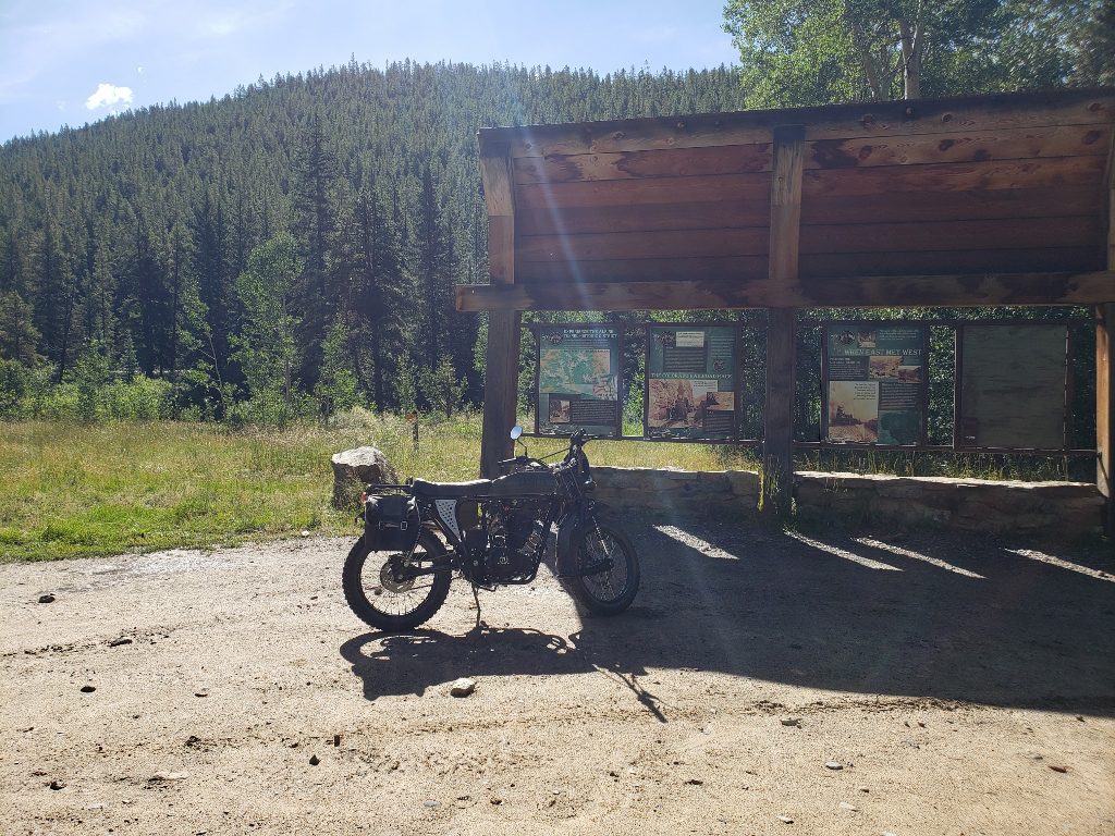
At Parlin, I turn down County Road 76, a paved road with a 45 mph speed limit. It wanders to and fro around the countryside, and the Gryffin is right at home moseying along at or below the speed limit. I soon pass through Ohio City (spoiler alert: it’s not a city!) and then on to Pitkin. Pitkin is where the pavement ends and the fun begins. I make my way through town and head out Forest Service Road 765, a fairly smooth, unpaved road. The landscape is definitely getting a bit more rugged by now, and after rounding a corner I see what I am looking for – Forest Service Road 839, the road to the Alpine Tunnel. There is a nice display at the junction telling about the area:
The road starts out smooth, but within a short distance it is rough and rocky, showing the effects from decades of off-road vehicle use and erosion. I revert to my mountain biking days and do my best to pick the smoothest line through the rocks. Most of the time is spent at a fast idle in first gear. Occasionally, the trail smooths out and I can open it up a little bit in second gear. But, that doesn’t last long, and it’s back to first gear, picking my way through the rocks.
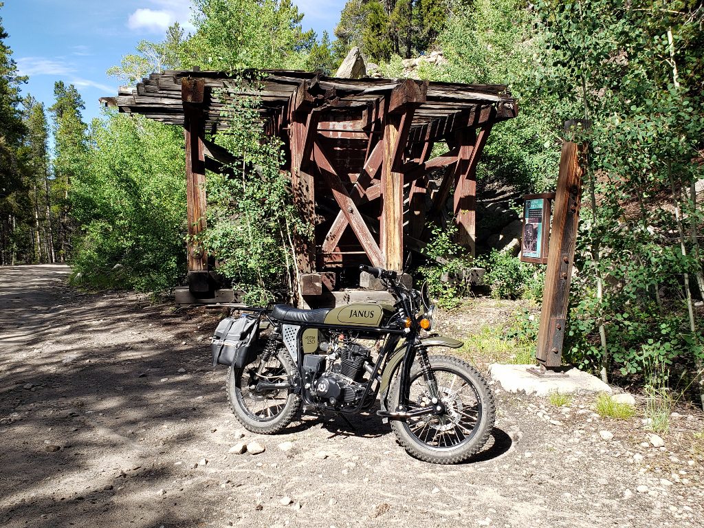
The roadbed climbs at a relatively steady 4%, although going up it really doesn’t seem like much of a grade. What is noticeable is how quickly Quartz Creek is dropping away in the valley! The scenery just keeps getting more amazing with every passing mile. Before long, I make it to the remains the Midway water tank, named because it is located midway between Pitkin and the tunnel:
Even in August, the weather can be cold in the mountains. The forecast had called for temps in the 50 – 70 degree range in Gunnison, but I didn’t know what the temperature would be at 11k+ feet, so I had dressed in layers. The slow riding and physical effort of picking the best line through the rough road is beginning to make me sweat as I make my way up to the next landmark, the Williams Gulch water tank. It is a good place to take a break, drink some water, and shed a layer of clothing:
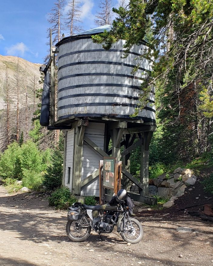
During the break, a man on a four-wheeler stops to chat. He has just dropped his daughter off at a cabin somewhere in the mountains, and we talk about the rest of the trip to the tunnel. Of course, he asks about the bike, wanting to know what it is and who made it. We part ways and I start riding upgrade once again.
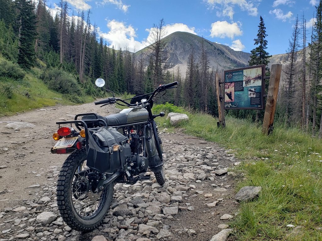
The next stop is the site of the former town of Woodstock. The small town was wiped out in 1884 by a huge avalanche, and was never rebuilt:
Just upgrade from Woodstock, the railroad made a hairpin curve known today as Sherrod Loop. The trail actually takes a shortcut uphill bypassing the loop itself, but quickly rejoins the upper grade. Volunteers have found enough abandoned rails in the surrounding area to reconstruct a short section of track on the loop, allowing us to see what it would have looked like back when it was in service:
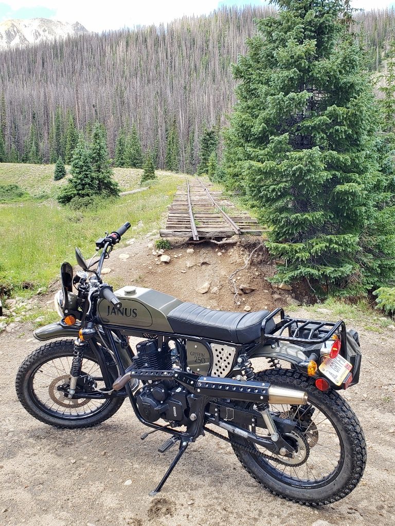
After navigating the steep shortcut, there is another trail that takes off to the north, while the railroad grade goes west. There was a washout upgrade a few years back, prompting this part of the railroad grade to be closed to four-wheeled vehicles. Fortunately, the Gryffin meets the requirements for a single-track vehicle, and I proceed past the barriers. This is the most scenic part of the line, and I don’t want to miss seeing any of the sites.
The grade crosses over the Palisades, large retaining walls built out of rocks without any mortar. It’s somewhat difficult to get a good picture without risking life & limb, but you can see one of the smaller rock retaining walls behind #109:
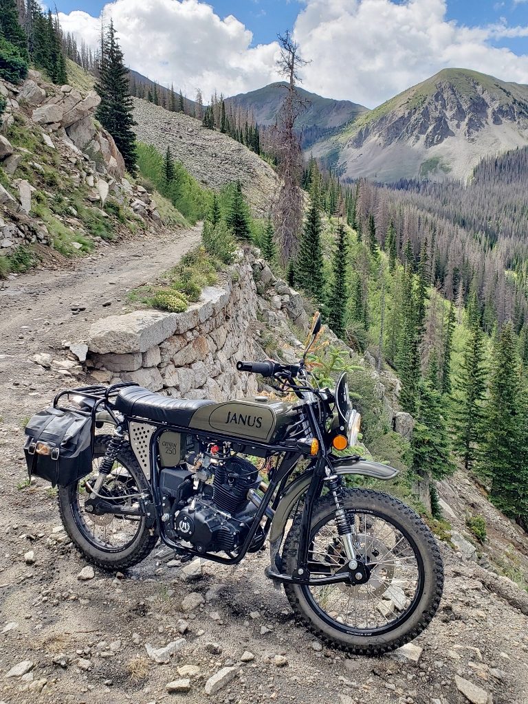
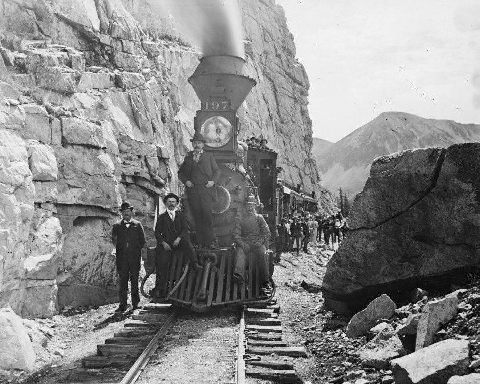
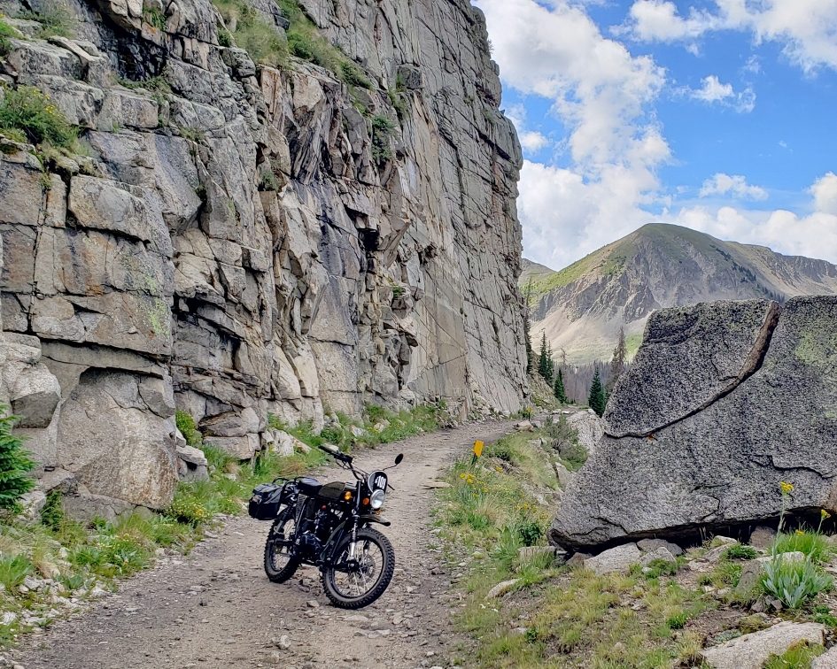
Near the end of one of the Palisades is a large, distinctive rock with a crack in it – Split Rock. This is the site of a famous photo taken in 1895, and a popular spot for pictures. Of course, I take a lot of different pictures from a variety of angles, hoping to get something that will match up with the original.
1895:
2022:
And a side-by-side comparison, 127 years apart:
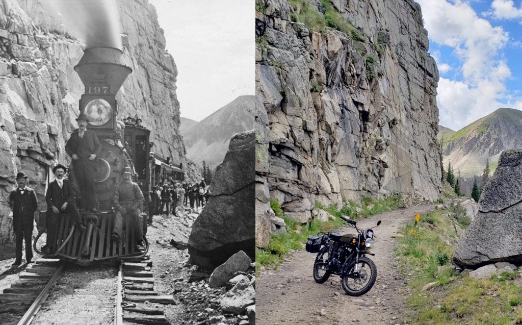
Eventually, after taking too many pictures at the site, I pull the bike to the side of the trail and take a moment to absorb the scenery. I’ve seen the 1895 picture countless times over the years, studying the locomotive, people, and surrounding area. The locomotive and the people are gone, but the scenery remains. I’m alone on the mountain, at least as far as I can see. The forest does a good job of absorbing the sound of other vehicles that must be around – I hear nothing but the slight breeze blowing over the mountain.
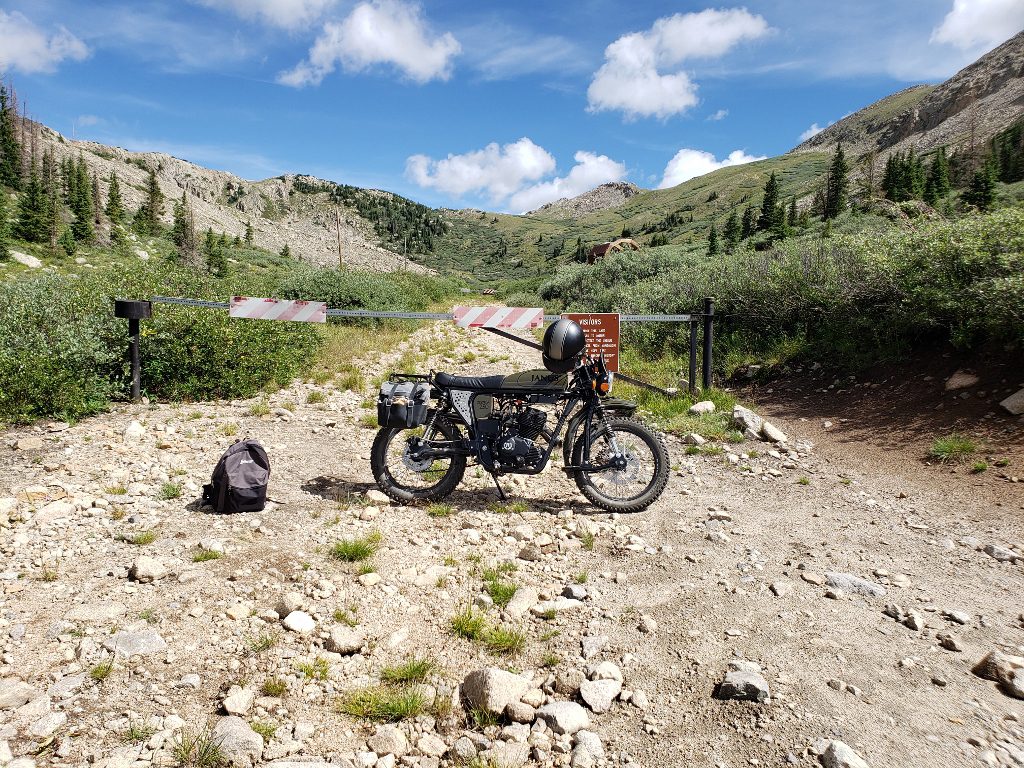
I eventually climb back on the bike and make my way upgrade. I carefully pass a couple of hikers, and before long I arrive at the Alpine Tunnel Historical Site. The site itself is off-limits to motorized traffic (for good reason), so I park the bike in front of the gate and take a quick picture:
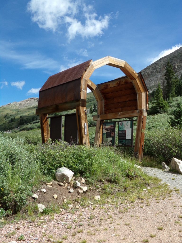
After moving the Gryffin off to the side of the parking area, I start walking up a narrow trail. A display section of the timbers that supported the interior of the tunnel has been constructed near the gate:
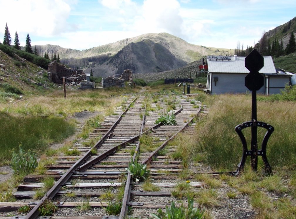
Passing through the entrance display, I make the hike upgrade to look over the area. Once again, old rails have been recovered and a short section of track has been rebuilt between the station and the remains of the rock enginehouse:
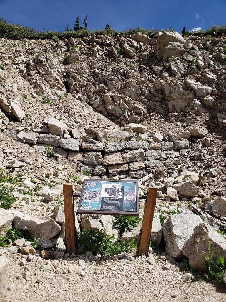
Continuing up the roadbed, I eventually arrive at the site of the west portal of Alpine Tunnel. The cut leading up to the portal has collapsed, blocking off the tunnel. The stacked rocks in the center of the picture are the top of the tunnel’s portal:
I take my time at the site, trying to take in all the details. Eventually, I make my way back downgrade, taking even more pictures of the remaining structures. The hikers have made it to the station just as I’m preparing to head back to the bike. I meet another couple that has arrived on a side-by-side, and we chat about the area, the buildings, the railroad, and of course, the Gryffin. Another couple arrives and we talk for a moment as well. Both couples have come over another trail that is apparently even rougher than the old railroad grade, and both wish they could take the easier way down! I eventually get on the bike and slowly start making my way back down the mountain. I see one of the couples ahead of me, turning back onto the rough trail over the mountain, but I continue past the barricade and take the “easy” way back.
I’m able to go a little quicker downgrade. Since the engine isn’t working hard, I can navigate a lot of the rocks in second gear at a fast idle, with the occasional downshift into first to crawl through the more difficult sections. I took plenty of pictures on the way up, but I still stop a few times on the trip down to grab more photos:

The roughness of the grade is getting exhausting at this point, and I have mixed feelings as I reach the bottom of the trail and turn back toward Pitkin. I’m glad to have a smooth road, but a bit sad that the adventure is coming to an end. After a quick stop in Pitkin for a souvenir T-Shirt, I continue back toward Highway 50. The beautiful day has turned cloudy, and now a steady rain is coming down. It only lasts for a few miles, and the sun comes out for the last couple of miles to the hotel. I park the bike and remove my helmet. As I get off the Gryffin, one question remains:
Did the experience live up to my expectations?
The answer? For once, the experience has far exceeded my expectations.
There are certain things in life which can only be fully appreciated in person. The trip to Alpine Tunnel is one of those experiences.
Now, if you will excuse me, I need to see if I can locate the site of the Corkscrew Gulch turntable…